Summary
Severe tropical cyclone Ofa has been reported as the ‘worst cyclone’ to hit Samoa since the late 1880s. Although, the cyclone was active during only 6 days it caused some significant/major damage in Tuvalu, Wallis, Tokelau, Samoa, American Samoa, Tonga and Niue. Ofa produced strong gales and very high seas that caused enormous damage amounting to $USD187 million (including $USD130 million in Samoa). 8 people were killed either by drowning or by being hit by flying debris, 20 injured while around 200 people had to be evacuated, mostly in Samoa. To better understand the role of waves in this natural disaster, an animation of the waves heights is shown below as well as a comparison between measured wave height and the hindcast. A document on the cyclones history, warnings and advisories issues before/during the event for different Pacific Islands and the details on its aftermath is also linked below.
Wave height and wind
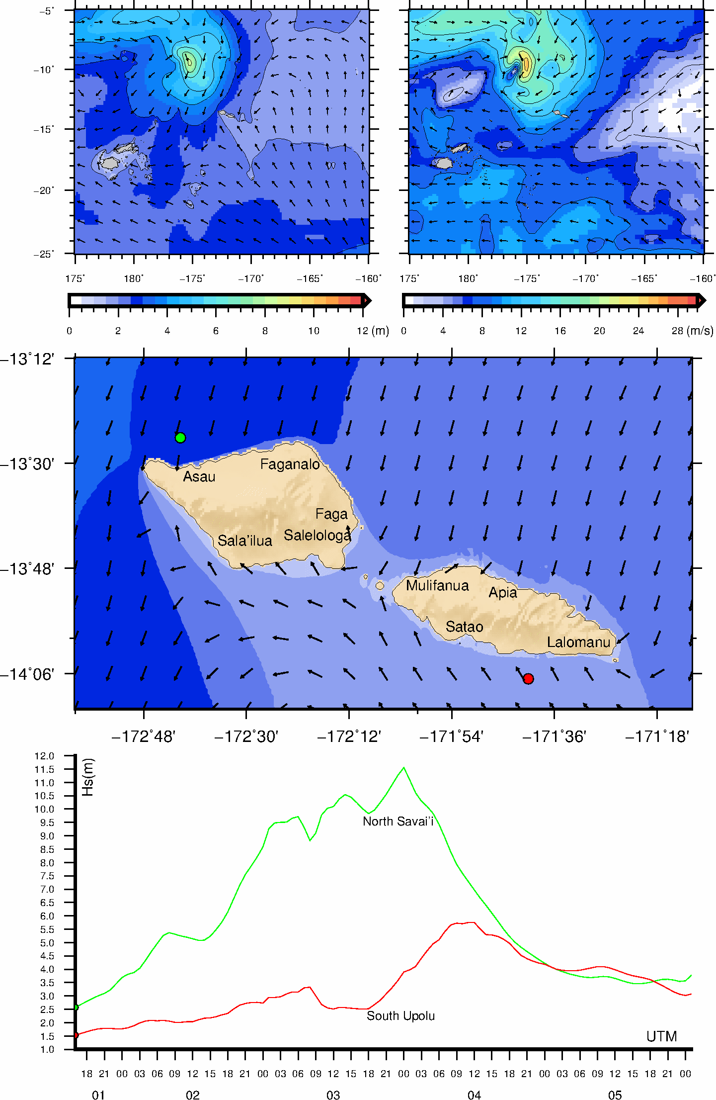
The animation below shows the evolution of the tropical cyclone and the associated wave heights. The top maps show the evolution of the cyclone waves (left) and wind (right) at the regional scale. The central map shows the waves nearshore in Samoa and the bottom graph shows the evolution of the wave through time at 2 locations nearshore of Samoa.
Wave measurements in Samoa
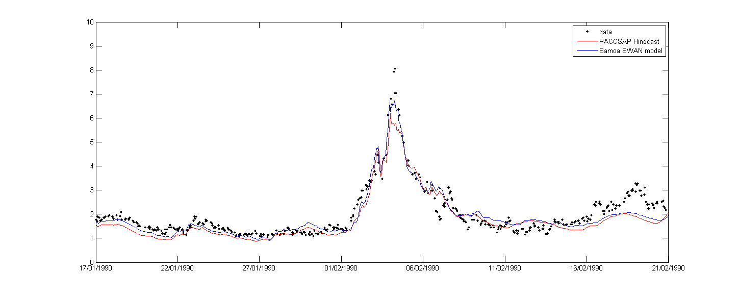
A wave recording device was deployed off the coast of Samoa when Tropical Cyclone Ofa occurred. This gives us a unique opportunity to accurately evaluate the wave height and to evaluate the validity of the wave models that hindcast the event.
Further reading
Techsec,D.R. (1990) Survey of cyclone Ofa damage to the Northern coast of Upolu, Western Samoa, SOPAC
Prasad R (1990) Tropical cyclone Ofa 31 January to 7 February 1990, Fiji Meteorological Services