Mean Wave Energy Period
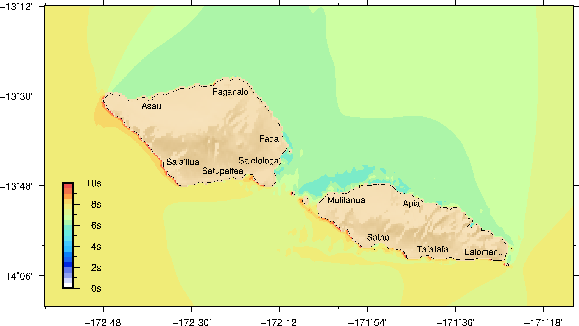
This page describes the mean wave characteristics for Samoa.
Samoa is located at a unique location in the South Pacific where it is exposed to waves from the three main directions: The south Pacific swells, the north Pacific Swells and the trade wind waves.
The South Coasts of Samoa are exposed to the south Pacific Swell. These waves are generated near the storm belt some 4,000 km South East of New Zealand. By the time they reach Samoa, they have a long period (15s and more) but they are often not very large (1—2m). The Southern Ocean storm belt is active all year around so these swell are always present but they are more frequent and larger during the South Hemisphere winter (June to August).
Compared with the Southern Ocean storms, the Trade Winds do not blow very strongly and can only generate medium waves with a wave period between 6 and 10s. These waves are directly associated with the wind so when the wind stops they disappear. The coasts exposed to the South East, East and North East are affected by these waves. The trade winds are dominant in the South Hemisphere winter (June to August).
The North Coasts of Samoa are exposed to the North Pacific Swells, these only occur during the North Pacific Winter (December to March). These swells are typically from the North and North East with wave periods of 12s and more.
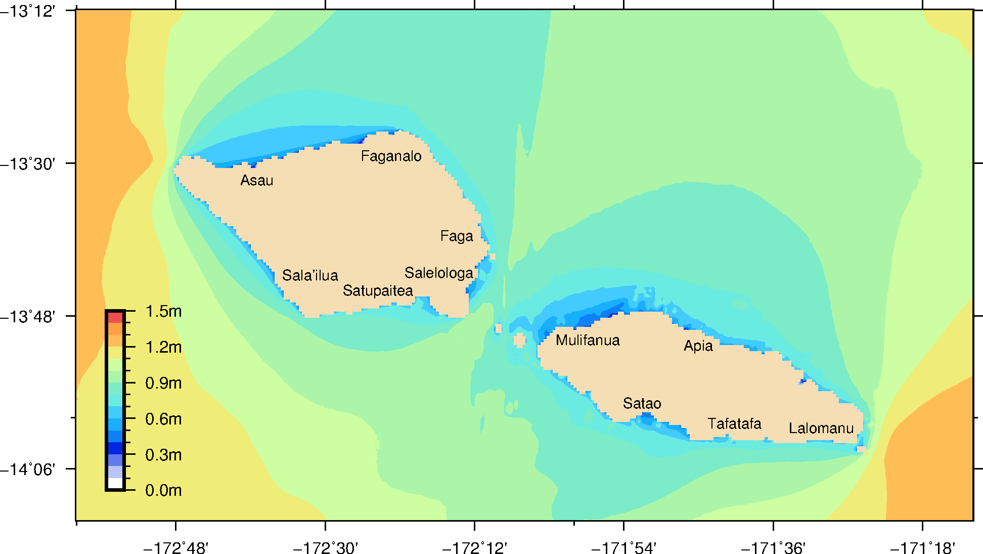
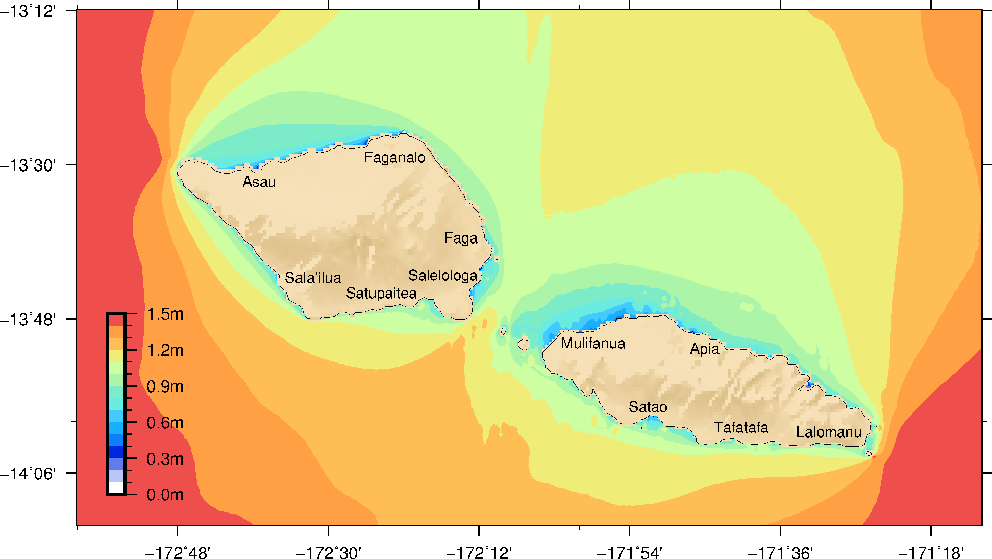
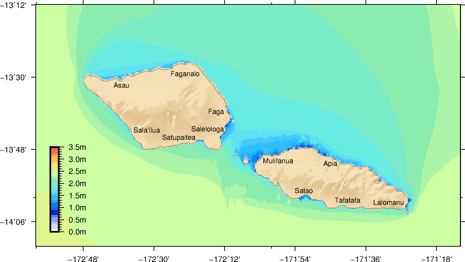
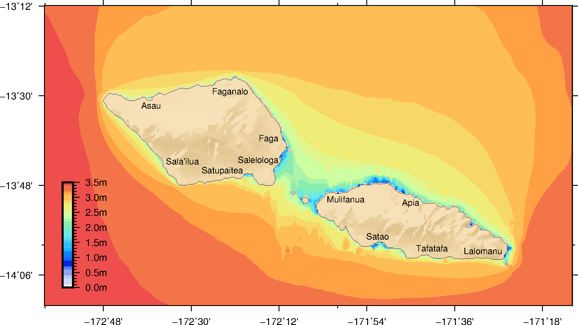
Small waves and large waves mean something different whether you live in an area exposed to the waves or in a sheltered location. The figures below map what would be considered tiny, small, large and severe waves at different location in Samoa.