Summary
In early December 2008 an unusual storm developed South East of Japan and moved toward the South. Although the storm dissipated before it reached the tropical Pacific, it created a large swell which, combined with elevated water level, caused widespread inundation in Micronesia, Marshall islands, Kiribati, Papua New Guinea and the Solomon islands. This event was responsible for widespread damage and displacement of an estimated 50,000 people across the 5 Pacific Islands nations.
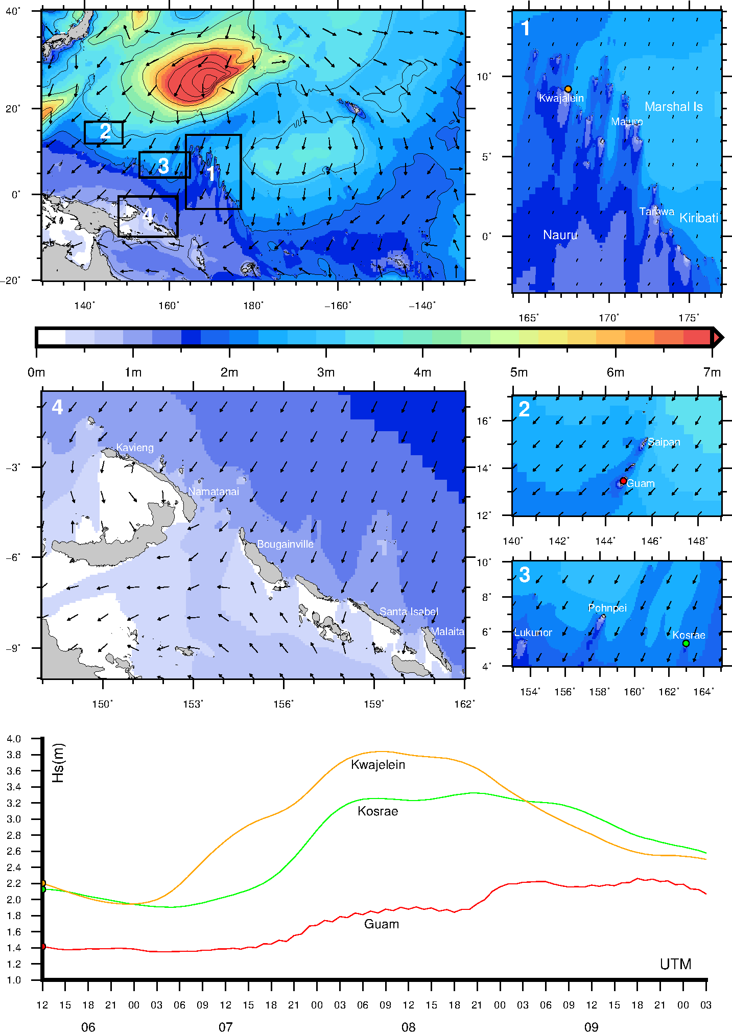
Wave height
The animation below shows the evolution of the swell generated from the storm . The top left map shows the waves at the regional scale with boxes highlighting areas covered in the adjacent maps. The top right map (1) shows the waves nearshore in Marshal islands and Kiribati, map (2) shows waves nearshore Saipan and Guam. Map (3) shows waves nearshore Pohnpei and Kosrae while map (4) shows waves nearshore Papua New Guinea.The bottom graph shows the evolution of the waves nearshore through time at 3 of the locations.
Further reading
Hoeke, Ron K., McInnes, Kathleen L., Kruger, Jens C., McNaught, Rebecca J., Hunter, John R., and Smithers, Scott G. (2013) Widespread inundation of Pacific islands triggered by distant-source wind-waves. Global and Planetary Change, 108. pp. 128-138.
50,000 villagers flee huge waves in PNG, East West Center
High surf inundates low-lying Majuro, East West Center
Tidal waves displace 75,000 in PNG, PINA
Islanders go hungry as rising waters destroy food crops, PINA