Bathymetry map
This page displays the bathymetry information for Samoa.
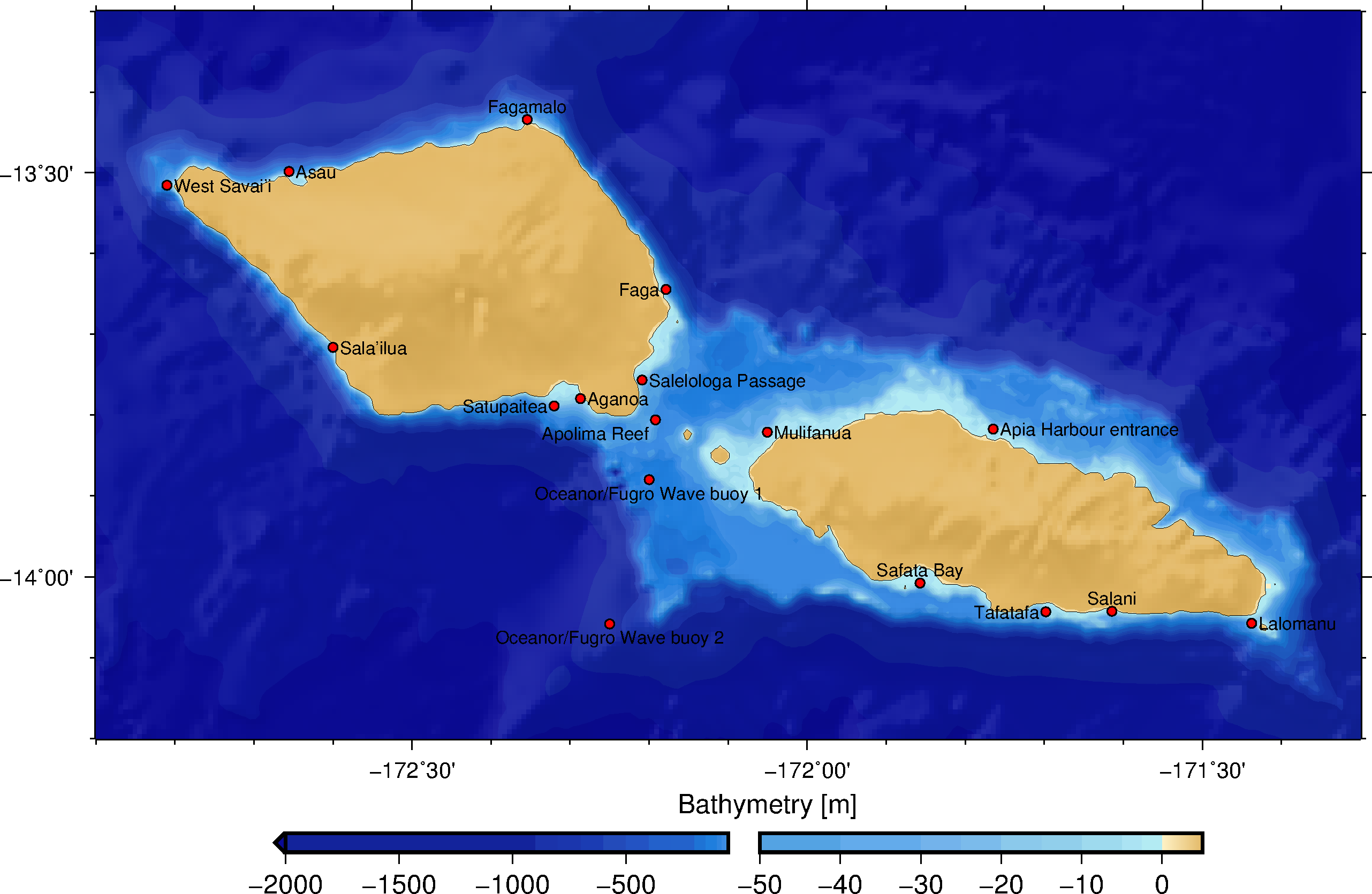
Bathymetry is the topography of the ocean floor relative to the sea level. Waves are greatly affected by the topography of the seafloor and it is therefore important to accurately capture the bathymetry features in wave models.
Numerical wave models require a bathymetry grid of high resolution. To create the bathymetry grid for Samoa, we combined multibeam data from PC Geoscience and NOAA, LINZ bathymetry and satellite image interpretation data for the missing nearshore bathymetry. The combined data was then interpolated to a regular interval of 0.006 degree, which correspond to a resolution of less than 650m.